Copyright 1998
Port Phillip Conservation Council Inc.
(A0020093K ABN 46 291 176
191
Oblique Aerial
Colour Prints of
|
||||||||||||||||||||||||
|
to Quiet Corner, BLACK ROCK
|
A1. Extensive
bitumen car parks covering foreshore
near |
A2.
The mouth
of the Mordialloc Creek, MORDIALLOC |
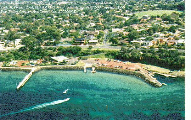
A3.
Beaumaris
Motor Yacht Squadron: National Estate 'Fossil
Site'
enclave; also partly excised
from |
|||||||||||||||||||||
|
Quiet
Corner,
|
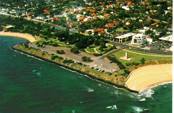
B1.
Green
Point and the Cenotaph, the
site of a proposed commercial
restaurant or 'Teahouse', and the Dr
Jim Willis Reserve, a dunes area
nearby to the left, with important
indigenous vegetation. |
B2.
St Kilda
Pier, showing the effect, on
sand build-up and depletion,
of the rock groyne at the
shore end of the pier. |
B3.
Parks Victoria is developing
the large area of public open space
here, and to the left, into the |
|||||||||||||||||||||
|
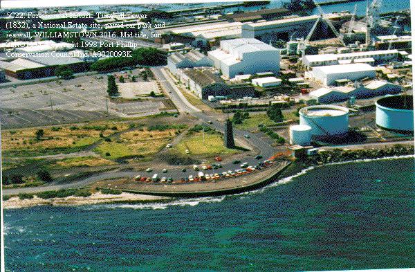
Lava Blister,
WILLIAMSTOWN
|
C1. 'The Jawbone':
valuable, intact mangrove
and samphire plant community,
protected for many decades by the
rifle range formerly on the land
behind it. It is within 10 km of
central |
C2.
|
C3.
Southern
end of The Spit. The saltmarsh,
which appears as the dark green
vegetation bordering the sea, is a
major winter habitat for the
endangered Orange-bellied Parrot (Neophema
chrysogaster),and is protected
by its National Estate
registration, and
international treaties such as Ramsar,
the CAMBA, the
JAMBAand
others.
AVALON |
|||||||||||||||||||||
|
Point
Wilson,
|
D1.
Recent
construction of conspicuous
aquacultural works on the coast just
east of Point Lillias, not long
after this area escaped having a
controversial major chemical storage
facility relocated there from a
long-established site at Contact
PPCC Inc. |
D2. Limeburner's Bay,
estuary of Hovell's Creek, with extensive mangroves
(Avicennia marina) near
the southern-most end of their
range in the world; and
end of Hume and Hovell's historic walk
from Sydney in 1824. Lieutenant
Matthew Flinders RN
climbed Contact
PPCC Inc. |
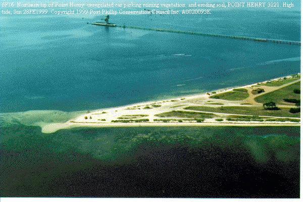
D3.
Northern
tip of Point
Henry, just north of
the large aluminium smelter there,
showing how unregulated car
parking
is destroying the
remaining vegetation, including
indigenous coastal vegetation. POINT
HENRY
Contact
PPCC Inc. |
|||||||||||||||||||||
|
Beacon Point
Reserve,
|
E1. Beacon Point
Reserve: bizarre road near to
edge of cliff, bleak nature of reserve
and eroded cliff follows
unfortunate long history as grazing
land right to edge of cliff. |
E2.
One of the
few areas of extensive coastal open
space left on Port Phillip. It
is a pressing case for open space
reservation. It is just west of
Point Richards, the area to which
the supposedly dormant Port Bellarine Tourist
Resort Act
1981 applies.
PORTARLINGTON |
E3.
The Cut, a
channel for boating purposes, cut
through the north of the peninsula
on which the historic |
|||||||||||||||||||||
|
Point
Nepean, PORTSEA
|
F1.
Point
Franklin: Lord Mayor of |
|
F3.
The coast
at Rye Pier, with extensive
provision for boat launching and
trailer parking. The rock revetment
at the beach end of the pier
interrupts the natural sand movement
along the beach, and has led to an
undesirable absence of sand on the
eastern side. |
|||||||||||||||||||||
|
Jetty
Road,
|
G1.
Tassell's
Creek and Balcombe Creek are the two
largest creeks on the |
G2.
Extensive
indigenous regrowth has colonized
the great variety of niches at the
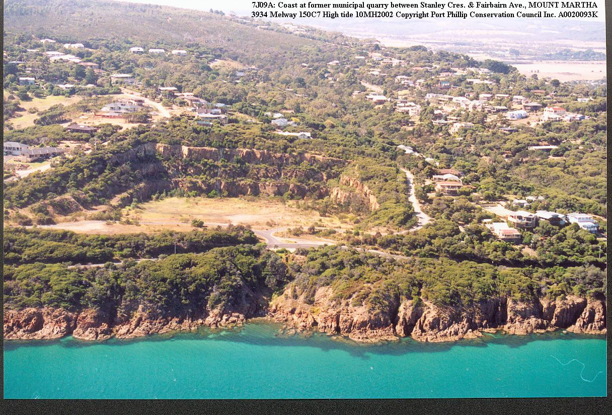
former municipal quarry at Mt
Martha. Massive impoverishment and
occupation of the terrain outside
the quarry now leaves the quarry as
a refuge for indigenous plants
and animals. Its vegetated
cliffs complement Port Phillip's
rugged coastal scenery here, and it
provides a variation of environment
from the remaining blanket spread of
buildings, very much better than
proposed building developments, with
their roofs, walls, windows,
roadways and lights would. |
G3. Mouth of Caraar
Creek, with much surrounding
tree cover and open space, but new
prominent houses keep arising. MORNINGTON
|
|||||||||||||||||||||
|
Sunnyside
Beach,
|
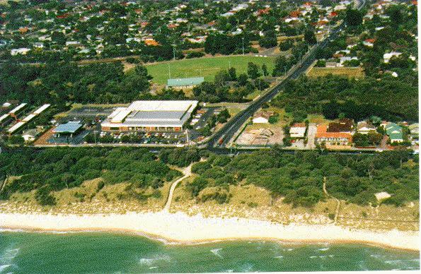
H1.
|
H2.
The coast
at Oliver's Hill. A 1998 proposal to
build a large marina here would
involve filling in many hectares of
the Bay in front of this cliff, and
would have a very large shed built
in front of it. FRANKSTON Contact
PPCC Inc. |
H3. Indigenous
coastal bushland on the well
managed and relatively wide
Foreshore Reserve, but with
unnecessary stresses due to commercial
zoning being too close,
at |
|||||||||||||||||||||


Last
updated on 2016-07-30