 |
|
|
|
|
|
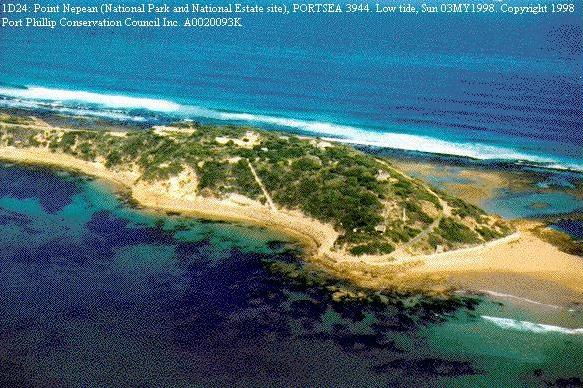
This Channels Deepening Study is ostensibly being undertaken by the Victorian Channels Authority to determine whether the proposal to deepen the entrance to Port Phillip Bay, the South Channel, the Port Melbourne Channel and the Yarra River, is economically and technically viable, as well as being environmentally sustainable and responsible. Deepening proposals being considered result from shipping companies using larger, deeper-draught ships. The depth of the South Channel and the Port Melbourne Channel is 13.1 metres. Vessels drawing 11.6 metres can enter at any time, and vessels drawing 12.1 metres only at high tide. The proposed deepening is about 2.5 metres. The proposals rely solely on economic benefits. Inherent Size Limitations of Port Phillip: Ever since World War II many very large ships, both merchant and naval, have had to bypass Port Phillip owing to its restricted depth. Despite that, Melbourne remains the busiest port in Australia, as numerous medium-sized ships can easily use it. Deepening of The Rip Ordered to be Stopped: In the 1960-80 period some underwater rock pinnacles in the narrow entrance to Port Phillip, The Rip, and their large, wide bases, were blasted and the resulting rubble was dispersed on the seabed. This blasting was ordered to be stopped following concerns that further opening of The Rip would let too much extra water from Bass Strait enter the Bay on each tide, thus threatening lower-lying bayside suburbs and sites such as the Werribee Sewage Treatment Plant. Large Increase in Tidal Range in the Bay: The tidal range, from low tide to high tide, outside the Bay is currently about 3 metres, but inside it is only 1 metre. If The Rip and the channels are deepened by 2.5 metres (19%) as proposed, the average sea level inside the Bay will of course continue to be the same as the average outside it, but the tidal range inside could be expected to increase by at least 19% also. It could thus increase to at least 1.2 metres. That would lead to the high tide level being at least 0.1 metres higher than at present. An extra 0.2 cubic kilometres of sea water would appear in the Bay with each high tide, available to be acted upon by strong winds. Unfortunately global warming predictions of rising average sea levels, and higher peaks of storm surges associated with lower pressures in atmospheric low pressure systems, would see both average sea levels and tidal peaks increase in the 21st Century, even if channels were not deepened further. The increases from both of those causes would add to the 0.1 metre increase in tidal extremes conservatively estimated above. The higher high tides would cause beach erosion and flooding of low-lying coastal land. The higher tidal range would disadvantage swimmers and boat users. Residents of bayside areas are already concerned at increased beach erosion and the increasing calls for sand replenishment operations. Numerous bathing boxes at Mt. Martha were destroyed in a storm in 2000. In the 1960-80 period, at the narrow land at the western end of what is now the Point Nepean National Park, just east of Port Phillip Heads, the ocean threatened to break through into Port Phillip Bay. To forestall that, authorities placed many thousands of tonnes of rocks on the Bay side of the threatened breakthrough, explaining that this was to prevent low-lying bayside land being flooded. Larger Wash from Larger Ships: The wash from the proposed very large ships will also create turbidity problems in the channels and the adjacent sea bed. Wave action from increased heights of wash waves generated by the wakes will relentlessly affect beaches adjacent to the channels. Disposal of Dredging Spoil: Where will increased dredging spoil be dumped? How will the increased turbidity the extra dumping causes affect surrounding areas and to what long-term effect? Deepening is a Temporary Expedient Only: A given amount of deepening can only cater for a defined increase in ships draughts. It offers no further margin to cater for subsequent increases in ships draught without yet another round of deepening, with then even more pronounced increases of tidal levels in the Bay. Ports that are naturally very deep possess a natural margin to cater for large future increases in ships draughts, but Melbourne does not. The economic imperatives that compel steadily-increasing economies of scale do not have a proven end-point, so Melbourne could sacrifice Port Phillips shoreline and some low-lying hinterland, yet still be - unlike deeper-water Australian ports - unable to cater for the worlds deepest ships. PPCC Inc. notes the "precautionary principle" that the Federal Government has accepted, and that state, local government and statutory bodies should heed. Preferred Alternative: A preferred alternative being authoritatively canvassed is that resources for new generation large ships should be rationalized to Fremantle, Darwin and Sydney. Containers could then by transported by standard gauge rail to the other major cities. With the West Australian link already in place, the Darwin-Adelaide link under construction, and the Melbourne-Brisbane-Mt. Isa-Darwin link now almost certain, this appears to be both viable and responsible. The idea that Victoria, connected to that nation-wide rail network, would suffer trade loss from this alternative is not convincing. Instead, there should be advantages through greater competition and saving of time if the rail alternative is adopted. There should be much greater flexibility in siting the loading and unloading terminals, as they would not be so tied to the present scarce coastal sites. The amount of trade would, at worst, be unaffected by a shift to an emphasis on railway transport. Conclusion: The Victorian Channels Authority stated in November 2000 that there would be full and open public consultation on this proposal. It has not instigated any consultation, and PPCC Inc. questions whether such a single-purpose body is the proper group to be overseeing the study. Port Phillip Bay is Melbournes greatest natural asset. It is under
threat as never before from a number of sources. Victoria should not subject
the Bays shoreline, or any of its low hinterland, to irreparable and disastrous
changes for a single-purpose temporary expedient. The credible alternative
of faster, secure, reliable, flexible and economical rail transport will
soon be in place, and Melbourne can still remain a viable port for medium-sized
ships.
Geoffrey Goode President
|